DigiForest is a pioneering project bringing together a multidisciplinary team of researchers from several universities, working alongside industry partners to create precise, data-driven solutions for sustainable forestry. Researchers from the Oxford Robotics Institute are playing a key role in putting transformative technologies in the hands of the forestry industry.
DigiForest is part of the Horizon Europe programme, the EU's programme for funding research and innovation from 2021 to 2027 with a budget of €93.5 billion. The project aligns with the programme's core objective of tackling climate change and helping to achieve the UN's Sustainable Development Goals, and seeks to addresses the challenge of developing sustainable practices for managing and protecting forests.
Oxford researchers involved in the project are combining advanced robotics and data analytics to explore how these technologies can advance forest management and increase the plausibility of sustainable forestry practices.
"The EU project involves about seven or eight universities, as well as a few companies, to develop technologies for digitising, so 3D reconstruction and mapping of forests," explains Associate Professor Maurice Fallon from the Oxford Robotics Institute.
"The reason to do it to this detail is that with forests that are clear-felled, it's pretty drastic business... to be able to move towards what's called continuous cover forestry, where you remove only a single tree, then you'd like it to be a more data-driven process rather than arbitrarily selecting.’
As the world's second-largest timber importer, the UK relies significantly on other countries for its supply. Dependency on foreign timber sources not only impacts the UK’s economy through import costs, but also raises questions about supply chain resilience, carbon footprint and responsible forest management. Additionally, the World Bank has estimated that global timber demand will quadruple by 2050. The need for better domestic forest management has never been more urgent.
Traditional forest surveying methods have limitations in their ability to meet these contemporary challenges.
Manual surveying is time-consuming and labour-intensive: surveyors are often faced with dangerous or inaccessible terrains, preventing comprehensive forest assessment; and the infrequency of surveys means changes in forest conditions might go unnoticed for extended periods of time. Human error and subjective assessments can lead to inconsistent data collection, leading to a lack of reliable measurements in the long-term.
Novel surveying methods rely on laser technology, particularly ground-based or aerial laser scanning.
While these can create accurate forest maps, neither method alone can measure everything we need to know about trees, such as their height, trunk thickness, and how dense their leafy canopy is. This is because each scanning method can only ‘see’ the forest from one perspective.
They are also time-consuming. For example, the most common approach used currently, terrestrial laser scanning (TLS), creates detailed 3D maps of forests but it can take up to two days to map just one hectare of forest - less than the size of a football field.
Even then, the resulting map requires considerable data storage and complex computer processing. These limitations create substantial gaps in our knowledge about forests. Without regular, detailed monitoring, it is difficult to track how forests are responding to climate change, disease outbreaks or invasive species.
7x more ground can be covered in a day compared to traditional methods
Early detection of disease can support targeted thinning, where weaker trees are removed to allow stronger trees to thrive. The DigiForest project is addressing this by developing autonomous systems capable of navigating and mapping forests. The project aims to develop technologies for 3D reconstruction and mapping of forests, with emphasis on individual tree analysis.
Oxford’s team have developed a real-time mapping and analysis system that enables online generation of forest inventories using mobile laser scanners. Their results have shown improved accuracy compared to TLS or manual measurements, with laser scanners mounted on backpacks able to map conifer, broad-leaf and mixed forests up to 7 times quicker than traditional methods.
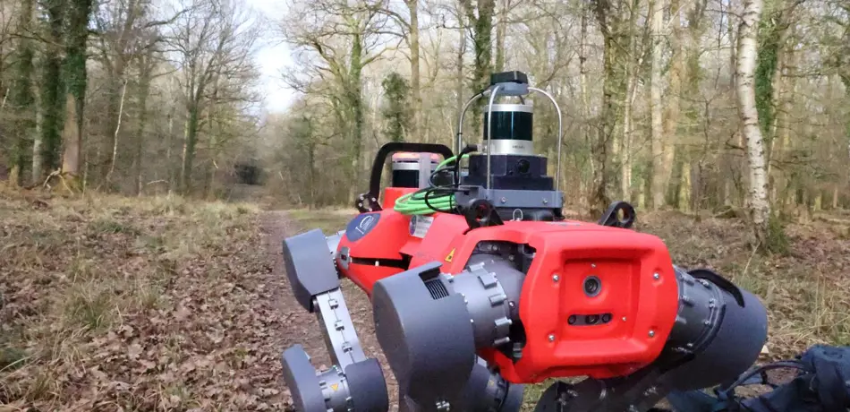
Additionally, the team is experimenting with robotic systems including drones and legged robots such as ANYmal. Able to operate in different weather conditions, access difficult terrain and collect standardised, high-quality data, these systems have much potential to be explored, although the team highlight these methods are currently experimental and face hurdles such as limited battery life.
"Working with a walking robot in a boggy field, up to its knees in mud, it just brings different things to the day job."
Associate Professor Maurice Fallon, Department of Engineering Science
These methods remove the need for time-consuming data processing - the information is ready to use as soon as the scans are completed. This innovative approach combines both ground and aerial scanning data into one complete picture, and does not need special markers placed in the forest - instead, it uses algorithms to automatically align the different scans - much like putting together a photo puzzle where each piece needs to match up perfectly with its neighbours.
Just as you would look for matching colours and patterns along the edges of puzzle pieces, the computer looks for matching features in the forest scans to create one complete picture.
The result is a detailed, comprehensive view of the forest that helps in better understanding and managing these vital ecosystems.
The researchers have tested this system in different types of forests – including conifer, deciduous and mixed forests – and it has proven to be just as accurate as traditional methods, with measurements precise to within 2 centimetres. "We can specify a bounding box of, let's say a hectare, and give the coordinates and maybe GPS of that box and ask the robots to reconstruct that," explains Professor Fallon.
"And the reconstructions they would achieve can be very quick, because it's maybe similar speed to human walking, but measuring things to the diameter of a tree to individual centimetre accuracy."
Beyond forestry, the technology employed by the DigiForest project could have broader applications for addressing environmental challenges. The team has explored how their robotic systems could be adapted for use in industries such as nuclear facility maintenance and inspection, where autonomous navigation and sensing capabilities are crucial for safety and efficiency.

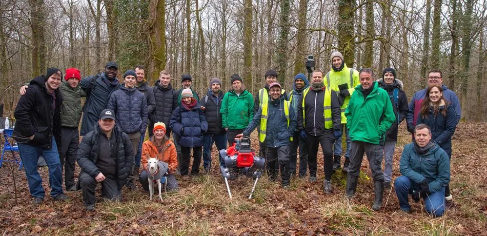
Digiforest trial 2024

Oxford researchers and Forestry Research partners in the Forest of Dean
Excerpt reproduced with kind permission from University of Oxford. Read the full case study: DigiForest: Transforming forest management with robotics
The role of community energy systems in achieving universal energy access
Expert comment

